HomeTagsPosts tagged with "weather warning"

weather warning

by

If you’re an early bird, you may have noticed the thick blanket of snow that has engulfed much of the country over night.

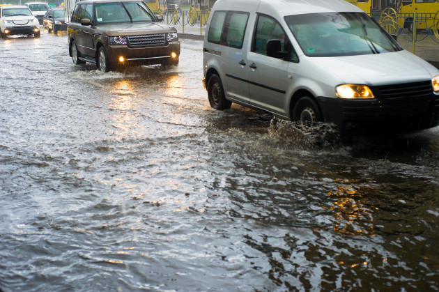
Thanks to the snow, motorists are advised to take care on the roads.

Snow, ice and compacted snow are a danger to drivers as a result of Storm Fionn.

The Road Safety Authority and AA Roadwatch have urged motorists to take care on the roads.

A number of weather warnings are in place around the country today.

A Status Yellow snow and ice warning is in place for the entire country and will not be lifted until 9am.

A Status Orange wind warning is also currently in place for counties Galway, Mayo, Sligo, Clare, Donegal, Leitrim, Cork and Kerry is in place until 3am.

Gusts of up to 120 km/ph are expected.

Trending

by

Temperatures across the country a set to plummet below freezing tonight, with lows of -6C expected in some parts.

Met Éireann have issued a Status Orange Low Temperature warning for Munster, Connacht, Donegal, Monaghan and Cavan, as well as inland areas of Leinster.

The warning is in place from 9pm tonight to 10am tomorrow morning.

Severe air and ground frosts are expected to hit the entire country and motorists are being advised to exercise extreme caution while travelling and to leave plenty of extra time for journeys.

As reported by brekingnews.ie, meteorologist Liz Gavin explained: 

"Tonight it's actually going to turn very cold, we are going to see temperatures ranging from -1C on the east and south coast to -5C or -6C well inland.

"So it'll really be inland areas of Leinster, Connacht, Munster and Donegal, Monaghan and Cavan that will see the lowest temperatures tonight."

Trending

by

It's looks like we're in for a wet and windy start to the New Year as Storm Dylan arrives just in time for the celebrations.

Met Éireann have issued fresh weather warnings ahead of the storm's approach with severe winds expected in most parts of the country.

A Status Orange wind warning is in place for Connacht, Cavan, Monaghan, Donegal, Longford, Louth, Westmeath, Meath and Clare. 

Western and northern counties are expected to be worst hit, with west to southwest winds reaching mean speeds of 65 to 80 km/h with gusts of 110 to 125 km/h.

A Status Yellow wind warning is also in place for counties Dublin, Carlow, Kildare, Kilkenny, Laois, Wexford, Wicklow, Offaly, Cork, Kerry, Limerick, Tipperary and Waterford where winds are expected to reach mean speeds of 45 to 65 km/h with gusts of 90 to 110 km/h.

Both warnings were updated at 8:00am on Saturday December 30, and remain vail from 9:00pm tonight to 12:00 pm on Sunday afternoon. 

Trending

by

Wrap up warm – the cold weather isn't going anywhere just yet.

Commuters are urged to take extreme care this morning as a low temperature warning remains in place across the country.

Last night saw temperatures drop to as low a minus four degrees Celsius in some places, resulting in widespread frost and treacherous conditions.

The cold weather looks set to continue today with maximum temperatures ranging from three to seven degrees.

Showers of sleet and hill snow are also expected, particularly in parts of the north.

Tonight will be mainly dry in the midlands and eastern parts of the country, though scattered showers will become widespread by morning.

Temperatures will become slightly milder overnight with highs of one to five degrees Celsius.

Trending

by

Unless you've stayed bundled beneath your duvet for the last day or so, you'll know that it's absolutely baltic outside.

And it's not about to get any warmer any time soon.

Indeed, Met Éireann have issued a Status Orange weather warning to the entire country ahead of below freezing temperatures and snowfall.

While today will be mostly dry, rainfall later tonight will eventually bring snow, with forecasters advising: "The rain will be heavy and persistent and will bring local spot flooding to the south and southwest. As it moves northwards it will turn to snow, bringing large accumulations to Connacht, the midlands and much of Leinster."

Temperatures will drop to as low as -5 degrees tonight, with winds remaining moderate to fresh southeast to east, becoming strong westerly in Munster by morning.

Forecasters say "Sunday will see further heavy rain and snow falls. Temperatures in the afternoon will struggle to rise above freezing in the north and will linger between 1 and 4 degrees for much of the country."

As of Sunday night, forecasters advise the entire country to exercise caution, saying: "The widespread, severe frost will bring treacherous driving conditions to the whole country with all areas at risk."

"Sleet and snow will continue for a time, but will gradually die away as the night goes on."

It's a weekend for an open fire and a mug of hot chocolate, ladies.

Trending

by

If you're still attempting to warm up after your morning commute, you're not alone. And it doesn't sound like this morning's weather is going to get any milder any time soon.

Met Éireann have issued a Status Yellow weather warning, forecasting snow, wind and ice for most parts of the country over the next 24 hours.

"The showers will turn increasingly wintry with falls of hail and snow – especially in the north, and a few will push further south this evening. Northwest winds will be strong and gust," reads the official website.

"Wintry showers will be widespread overnight and frequent in the north with accumulations of snow over inland parts of Ulster and other northern areas."

"Mainly dry across the south and southwest. Northwest winds will stay strong and gusty. A widespread sharp ground frost will form during clear spells with icy patches forming widely."

And as for tomorrow? Met Éireann warn it will be 'very cold again' on Friday,  with a few sunny spells, but with occasional wintry showers of hail, sleet and snow .

There will be further accumulations of snow over northern counties and over high ground elsewhere.

Ladies, time to rebuild the duvet fort.

Trending

Unless you have yet to surface from beneath your bed covers, you'll know that it is one hell of a day out there.

With that in mind, the Gardaí have issued a warning to motorists, in additions to updates on some of the worst affected areas at the moment.

One lane is blocked on the M4 outbound near Maynooth, at junction 4. Gardaí advise motorists to exercise caution on approach.

Local diversions are in place on the N3 Blanchardstown. The road is closed from Clonee Junction 4 inbound and diversions are in place via Damastown Road to the N2, to access the M50.

An earlier collision on the M50 at junction 6 Northbound has now cleared.

Garda are advising that if the road ahead is flooded to use alternative routes if possible, but do not attempt to drive through it.

Gardaí warn that flooded roads which appear shallow could be deeper than you think. People underestimate the force and power of water. They take unnecessary risks and their vehicle could be swept downstream.

A mere ½ ft of fast-moving flood water can knock over an adult. It takes just a foot of rushing water to carry away a small car, while two feet of rushing water can carry away most vehicles. 

It is NEVER safe to drive or walk into flood waters. Take extra care at night when it is harder to see flood dangers and drive to the road conditions.

You heard them, ladies.

Trending

by

Status yellow rainfall warnings have been issued across the country as the wet weather has arrived. 

Galway, Mayo, Clare and Kerry can expect up to 50mm of rainfall, and the warning is in place until 6pm this evening. 

Offaly, Limerick and Tipperary can expect up to 40mm of rainfall, and the warning is also in place until 6pm this evening. 

The Road Safety Authority has asked drivers to slow down on the roads.

Drivers are warned to increase their breaking distance between vehicles. 

Many roads are coated in surface water, and so aquaplaning is a risk. 

Flash flooding may also occur. 

Stay safe out there. 

Trending

by

Met Éireann have issued two separate weather warnings as heavy showers and strong winds are set expected to batter the country's west coast today.

A status yellow rainfall warning is in place for counties Donegal, Galway, Leitrim, Mayo and Sligo, while a status yellow wind warning is also in place for these counties, as well as Clare, Cork and Kerry.

The warnings will remain in place until tomorrow morning and weather chiefs have said that accumulations of 30 to 50 mm are expected.

A developing low pressure system in the Atlantic will result in wind speeds of up to 65km/h are expected, with gusts of up to 110km/h.

The outlook is not much better for other parts of the country, with scattered showers due to become more persistent by evening time as well as strong southwesterly winds. Top temperatures of 16 to 17 degrees.

Tomorrow will be cool and blustery, though it's thought most showers will become isolated by evening. Top temperatures of 14 to 16 degrees.

Well, that's summer well and truly over anyway. Sigh.

Trending

by

According to Met Éireann, a heavy spell of rain is in store for us this weekend. 

A status yellow weather warning is in place over much of the country as the national forecaster predicts heavy rain showers into tonight. 

'Showers, some heavy and prolonged affecting parts of Ulster, Connacht and north Leinster today with the risk of an isolated thunderstorm in Ulster this afternoon,' Met Éireann has warned.

'Lengthy dry periods elsewhere with some sunny spells and just a few passing showers.'

As for Electric Picnic next weekend, the outlook remains mixed according to Met Éireann.

'Outlook is for rather mixed weather to continue, there will be some dry bright periods, but showers or spells of rain at times also.'

So bring that rain poncho…

Trending

by

As the saying goes, all good things must come to an end, and in what was a pretty glorious week weather wise, that can only mean one thing – thunderstorms and torrential downpours.

Yep. Just when you thought we might actually get a bit of a summer this year, Met Éireann issue the entire country with a status yellow weather warning.

Heavy showers will spread eastwards across the country today, bringing a risk of thunder and localised flooding, though it will gradually clear through the evening. Highest temperatures of 17 to 20 degrees.

Tomorrow will start off dry in the east, however, showers will become widespread by early afternoon. Temperatures will fall slightly with expected highs of 13 to 17 degrees.

It's a similar story heading into the weekend, however Saturday looks set to be the best day, with sunny spells and highs of 16 to 19 degrees.

It was fun while it lasted, guys. 

Trending

by

If you were an early riser, you may have caught some of the rain that was lashing down this morning, so it may come as a surprise that a wether warning has been issued today because of the heat.

Met Éireann have issued the warning for Dublin, Carlow, Kildare, Wicklow and Meath, as temperatures are set to reach 28 C.

However, the day will not kick off with sunshine, as heavy cloud cover and rainfall covers most of the country. 

'Scattered showers this morning will turn heavy with the risk of some thundery downpours before clearing northeastwards.'

'Later it will become mostly dry over much of the country with sunny spells developing and just a few scattered showers remaining, mainly in the north and northeast.'

'It will be very warm and humid with top temperatures reaching 22 to 28 degrees, highest in parts of Leinster.'

So hopefully this rainy tropical weather will make way for a bright and sunny day. 

Just remember to wear a hat and sunscreen with this warning in place. 

Trending