HomeTagsPosts tagged with "rain"

rain

by

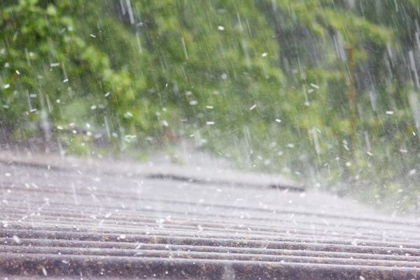
Get the umbrellas out and ready: Met Eireann has issues a rainfall warning for 18 counties amid cautions that up to 40mm of rain is to be expected.

Leinster and Munster have received the warning, which is in place from 7pm this evening until 7am on Friday morning.

The national forecaster said in a statement to the Independent: "Heavy Rain will spread from the south Thursday evening and night.

While much of today will likely remain clear and dry, "heavy rain will develop in the south and will spread northwards over the southern half of the country by nightfall" with maximum temperatures of up to 22C.

"Heavy rain will spread from the south Thursday evening and night," the national forecaster warned.

"Accumulations of 25 to 40mm will occur over a relatively short time period. Spot flooding is likely," a Met Eireann forecaster said.

Munster is predicted to be the worst affected, as downpours will be heavy with a risk of localised flooding in many areas.

Heavy rain will continue on Friday morning nationwide with a risk of thunder and temperatures of 13C.

The bad weather looks set to continue into the weekend, which is a shame considering the many events taking place in Dublin. Playstival in Airfield Estate and the Wine and Cheese festival in Eatyard are scheduled to go ahead.

Rain will persist in northern parts of the country throughout Saturday and Sunday.

Trending

by

Do you know any especially wildly cranky siblings or grumpy but chilled out friends that you reckon deserve to have a massive winter storm named after them? We can think of a few.

Now is finally your chance to get a storm named in your honour, or as a tribute to a pal or member of your family. You could even get one named after your worst enemy, if that's the mood you're in.

National forecaster Met Eireann have joined forces with the UK Met Office to launch their new 'Call for Storm Names' scheme this winter, and want our help. 

The 'Name our Storms' scheme aims to raise awareness of severe weather before it strikes.

A storm warrants a name when the Met Office or Met Éireann will issue an orange or red weather warning, and you buy all the booze and bread from Tesco and barricade your gaff.

The names are chosen based on the public's submissions every year, and memorable weather events in recent years include Storm Emma, Storm Ali and Storm Ophelia.

Remember when Lidl was raided by a JCB during Storm Emma in Tallaght last year? Mad times, they were.

Storms are named in alphabetical order in the sequence they occur, with each storm alternate between the first letter of a male name and female name, similar to the pattern created by the US National Hurricane Centre in the 1970s.

Storms starting with letters Q, U, X, Y and Z won’t be used, unfortunately. The first storms last year were named Ali and Bronagh, but this winter the first storm will be female. 

Forecasters will avoid names with 'resonance' in the weather world, like 'Katrina' or 'Charlie' and famous/notorious names will be avoided. There'll be no Storm Greg (O'Shea), Storm Boris or Storm Trump. 

Use the hashtag #IrishStormNames on Twitter to send your suggestion, email Met Éireann at stormnames@met.ie or write to Evelyn Cusack, Met Éireann, Glasnevin Hill, Dublin 9.

We deserve a Storm Maura after her explosive entrance into this year's Love Island villa, don't you agree?

Trending

Met Éireann has issued a status yellow weather warning today for five counties, with heavy rain expected to hit the east of the country until Wednesday morning.

The official warning is in place for Dublin, Kildare, Louth, Wicklow and Meath. Motorists have also been urged to take extra care on roads this morning as a result of the wet weather.

Forecaster Pat Clarke said: "The next 24 hours will be the coldest and the wettest."

Clarke continued; "Obviously drivers will have to be careful. There could be some water on the roads and there is the possibility of hail."

A wind-chill factor around coastal areas will contribute to the frosty feel of the weather, with temperatures expected to fall to five degrees.

"There is the possibility of downpours and there may be some thunder mixed in," Mr Clarke said. Dublin Fire Brigade have also issued a road warning:

Unusually, the current inclement conditions have predominantly hit the east coast, Met Éireann says.

The weekend is expected to be far less damp, on Thursday the temperature will rise to 8 degrees and fewer showers will occur.

In terms of traffic, AA Roadwatch has urged motorists to slow down as roads across the country are very slippery this morning:

"Roads are damp or wet in much of the country this morning following overnight rain. It's particularly wet in parts of the midlands and along the east coast."

"When driving on wet roads slow down and leave a safe distance between yourself and the vehicle in front."

West Munster is getting the best of the weather at the moment, but tonight will be cold with further rain and hail showers scattered nationwide.

Trending

People gathered under bus stops yesterday as torrents of rain piled down throughout the day.

We’ve had horrible weather at the tail end of this week and unfortunately, it doesn’t look like tomorrow is going to be any different.

More rain has been predicted by Met Éireann as well as the possibility of hail and thunderstorms.

Meteorologist Joan Blackburn announced what tomorrow’s weather will look like on RTE Radio One.

“It will be cool and bright tomorrow with mist and early frost clearing. Sunny spells and scattered showers are likely during the morning.

“Those scattered showers will become widespread in the afternoon, some if these showers heavy or of hail, and there’s a risk of isolated thunderstorms.

“The heavy showers will continue overnight,” she warned.

A high of 12 degrees is expected tomorrow and the hail and thunderstorm prediction will carry on through Monday.

The rain will continue until Wednesday evening when it is expected to dissipate into scattered, light showers.

So, make sure to bundle up for the rest of the weekend and stay warm. It’d be best to postpone outdoor plans for now.

The good news is that traffic is said to be running more smoothly after yesterday’s horrendous delays.

And hopefully, Irish transport will be prepared for the upcoming weather come Monday.

Trending

Whether it’s going for walks, coffee breaks with friends or a weekly yoga class, we all know how necessary that glorious ‘me time’ can be. 

Taking some time out of your busy day to focus on yourself is hugely beneficial for your body and mind, and it's not as difficult or time-consuming as you might think.

Mindfulness is the practise of simply being aware of your emotions and accepting them for what they are. 

The technique is best described with the acronym RAIN

R – Recognise the emotions you’re feeling

A – Accept the experience you’re having

I – Investigate your experience. Where are the emotions in your body?

N – Non-identification – remember that the emotions you are experiencing are only temporary and do not define you.

Benjamin Reisterer, a therapist at Mindful Counselling GR, described the practice:

"It's really about just slowing down and paying attention in a non-judgmental way."

"Take a deep breath and really understand what's upsetting you in that moment you can communicate on more of a mindful level and a more authentic and respectful level."

He added, "The more that you slow down and kind of pay attention to it the more you'll understand what's going on and how it's affecting you.’’

Benjamin also created, MetaFi, a mindfulness app, designed to help strengthen the user's emotional connection between their mind and body. 

He likened mindfulness to physical exercise. The more you do it, the stronger you get.

"The more you do it, the more results that you have. But if we're really paying attention to the physiological responses, sometimes that's our first clue to what we're actually experiencing in that moment."

By simply taking the time to become aware of our emotions and letting them exist as they are, we can regain some control and over time develop a healthier, more positive outlook on life, 

Trending

by

Status yellow rainfall warnings have been issued across the country as the wet weather has arrived. 

Galway, Mayo, Clare and Kerry can expect up to 50mm of rainfall, and the warning is in place until 6pm this evening. 

Offaly, Limerick and Tipperary can expect up to 40mm of rainfall, and the warning is also in place until 6pm this evening. 

The Road Safety Authority has asked drivers to slow down on the roads.

Drivers are warned to increase their breaking distance between vehicles. 

Many roads are coated in surface water, and so aquaplaning is a risk. 

Flash flooding may also occur. 

Stay safe out there. 

Trending

by

Met Éireann have issued two separate weather warnings as heavy showers and strong winds are set expected to batter the country's west coast today.

A status yellow rainfall warning is in place for counties Donegal, Galway, Leitrim, Mayo and Sligo, while a status yellow wind warning is also in place for these counties, as well as Clare, Cork and Kerry.

The warnings will remain in place until tomorrow morning and weather chiefs have said that accumulations of 30 to 50 mm are expected.

A developing low pressure system in the Atlantic will result in wind speeds of up to 65km/h are expected, with gusts of up to 110km/h.

The outlook is not much better for other parts of the country, with scattered showers due to become more persistent by evening time as well as strong southwesterly winds. Top temperatures of 16 to 17 degrees.

Tomorrow will be cool and blustery, though it's thought most showers will become isolated by evening. Top temperatures of 14 to 16 degrees.

Well, that's summer well and truly over anyway. Sigh.

Trending

by

According to Met Éireann, a heavy spell of rain is in store for us this weekend. 

A status yellow weather warning is in place over much of the country as the national forecaster predicts heavy rain showers into tonight. 

'Showers, some heavy and prolonged affecting parts of Ulster, Connacht and north Leinster today with the risk of an isolated thunderstorm in Ulster this afternoon,' Met Éireann has warned.

'Lengthy dry periods elsewhere with some sunny spells and just a few passing showers.'

As for Electric Picnic next weekend, the outlook remains mixed according to Met Éireann.

'Outlook is for rather mixed weather to continue, there will be some dry bright periods, but showers or spells of rain at times also.'

So bring that rain poncho…

Trending

by

Get your umbrella and wellies out – or better yet just stay indoors. 

Hurricane Gert has arrived in Ireland, and according to Met Eireann, she has approximately no chill when it comes to bringing the rain to our little island. 

A status yellow national weather warning is currently in place, as the weather forecasters predict heavy rainfall for Sunday and Monday. 

We can also expect humid conditions, high temperatures of 17-19 degrees and heavier rain. Gorge. 

'Warm, humid conditions expected to develop through Sunday, lasting into the early days of next week, will bring spells of heavy rain leading to potential accumulations of 30 to 50mm, with highest totals in the mountains,' reads the warning. 

Trending

by

As the saying goes, all good things must come to an end, and in what was a pretty glorious week weather wise, that can only mean one thing – thunderstorms and torrential downpours.

Yep. Just when you thought we might actually get a bit of a summer this year, Met Éireann issue the entire country with a status yellow weather warning.

Heavy showers will spread eastwards across the country today, bringing a risk of thunder and localised flooding, though it will gradually clear through the evening. Highest temperatures of 17 to 20 degrees.

Tomorrow will start off dry in the east, however, showers will become widespread by early afternoon. Temperatures will fall slightly with expected highs of 13 to 17 degrees.

It's a similar story heading into the weekend, however Saturday looks set to be the best day, with sunny spells and highs of 16 to 19 degrees.

It was fun while it lasted, guys. 

Trending

by

Yesterday was the hottest day of the year so far and the warmest May day at Malin Head since records began .

Temperatures rose as high as 26 degrees in some areas, but unfortunately, this glorious spell we're having won't be sticking around.

Friday will be a warm day with highest temperatures of 25 degrees, but heavy thundery showers will spread over parts of the west, and there's plenty more where they came from.

Thundery rain is forecast for most of the country in Saturday morning, with fresher spells developing later in the evening. Top temperatures of 15 to 20 degrees.

Temperatures will fall slightly on Sunday and early next week, but it will should stay mostly dry with highs of 18 degrees in light southwesterly breezes.

Rain will develop along the west coast on Tuesday morning and will slowly move across the country during the day.

The rest of the week remains 'changeable' according to Met Eireann, so fingers and toes crossed for the June Bank Holiday weekend. 

Trending

by

Unless you were very lucky and had a bit of a lie-in this Friday morning, you will probably have noticed that the rain has returned.

We knew the fair weather was too good to last, but we didn't expect it to dissapear quite so soon.

The rain is set to continue into the weekend, with a mix of heavy rainfall and scattered showers. 

Met Eireann is warning that the high levels of rain over the next few days will also bring a risk of localised flooding.

'Mixed weather is expected to continue through much of the outlook period with the potential for some high rainfall accumulations over the next few days, bringing a risk of localised flooding.'

Today is set to be rainy with a risk of thundery downpours. However, it won't get too cold, with temperatures still reaching a potential 18 degrees.

Tomorrow will be cooler with yet more rain, but Sunday will be bright with scattered sun showers. 

Trending